
Deer Park Neighbor Records by Block
For nearby Deer Park parcels, begin with sources that have an address or map key. The city GIS provides municipal map context and parcel attributes. HCAD provides the appraisal-account view. The County Clerk connects a parcel's legal description to recorded instruments. Community sources can help identify an association or a local organization, but they do not turn into a household roster. Treat the sources as separate layers, then compare dates and parcel identifiers.
| Source | What It Shows About a Block | Access |
|---|---|---|
| Deer Park GIS parcel and city-limits layers | Parcel geometry, site-address attributes, subdivision context, and municipal map relationship. | Official city GIS service. |
| HCAD property search | Appraisal account, site address, owner and mailing-address fields, legal description, and value attributes. | Official HCAD search and parcel viewer. |
| Harris County Clerk real-property search | Recorded grantor, grantee, restrictions, maps, and legal-description references. | Official Clerk index, images, and historical route. |
| TREC management certificates | Association name, subdivision lead, registered management or contact information, and certificate date. | State search by name, county, city, ZIP, or association type. |
| Deer Park Chamber directory | Business and member affiliation categories. | Local Chamber directory, not a resident source. |
An HCAD owner field is not proof of current occupancy. The city parcel layer likewise is a current map service, not a people directory. When the question is municipal location, use the city-limits geometry. When it is recorded ownership history, continue to the Clerk rather than relying on an appraisal result alone.
Deer Park Neighbor Maps and City Limits
The official Deer Park city-limits service lists current map layers for city limits, roads, railroads, the ship channel, drainage, parks, zoning, and the ETJ. Pair it with the parcel layer before describing a nearby address as inside Deer Park. The city's FAQ uses Highway 225 on the north and Underwood Road on the east as broad orientation cues. Those roads are not a parcel-level boundary test.
The city GIS entry point is the appropriate current map source for checking whether a selected parcel falls within the municipal polygon. It cannot establish household membership, and its boundaries should not be treated as a survey. For a postal address near La Porte, preserve the site city, ZIP, and geometry rather than applying a city name from a nearby label.
Deer Park city-limits GIS supplies the current map-layer context for this step.
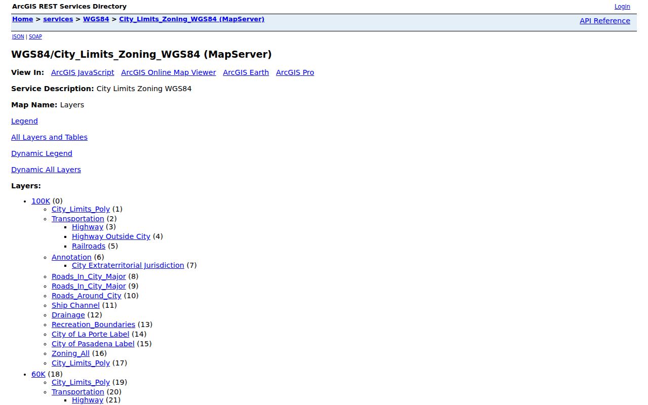
The layer inventory is a useful starting point for checking location, road context, and municipal geometry around a block.
Map Deer Park Neighbors Parcel by Parcel
Use a small-radius method. It avoids treating a long street or a ZIP as one neighborhood and makes the evidence trail reviewable. The process runs from address to parcels, then owner information, then city and privacy limits.
- Locate the known address in the Deer Park GIS or the HCAD parcel viewer and capture the account, site address, and legal description.
- Inspect the touching or immediately surrounding parcels, recording each separate account and the map relationship rather than assuming a street sequence proves adjacency.
- Open each selected account in HCAD and compare the site address, owner field, mailing address, subdivision, and legal description.
- Use the legal description in the County Clerk index to review a recorded deed, plat, restriction, or other instrument when that is relevant to the parcel history.
- Check the city-limits layer and privacy restrictions before describing any person or address. Stop where the source does not support the conclusion.
For a full named-street research path, use the Deer Park street directory. A block method should remain focused on immediate parcels, not expand into an unsupported roster.
Deer Park Neighbor Parcel Fields
The Deer Park parcel REST layer exposes useful map-to-record fields: acct, SiteAddress, SiteCity, SiteZip, Subdivisio, yr_impr, building and land-area values, total values, and PRECINCT_2. The account number connects a GIS point with an HCAD lookup. The subdivision and legal description are often safer ways to relate nearby parcels than a generic neighborhood label.
HCAD's advanced form can refine a block search with property street name, beginning and ending street numbers, ZIP Code, owner name, legal description, neighborhood number, key map, or map facet. HCAD permits up to 3,001 results in one search. Split a broad result by street number range, subdivision, school district, neighborhood number, or map facet rather than treating a capped result as complete.
Note: The appraisal owner field may differ from the current occupant, and a homestead indicator is not proof of household composition or continuous residence.
Deer Park Neighbor Association Leads
The Texas Real Estate Commission management-certificate search accepts HOA or POA name, county, city, ZIP, and association type. In the reviewed Harris County and Deer Park search context, the observed names were Villages of Deer Park HOA, Magnolia Estates HOA, Ivy Oaks HOA, and Deer Park Meadows East Community Association. Search the live record again before relying on a name or status, because certificate details can change.
| Association lead | What the certificate can support | What it cannot establish |
|---|---|---|
| Villages of Deer Park HOA | Association-name and governance-contact lead. | Current membership or a household list. |
| Magnolia Estates HOA | Association-name and certificate lead. | Whether a selected parcel belongs to the association. |
| Ivy Oaks HOA | Association-name and certificate lead. | Current owner or occupant identity. |
| Deer Park Meadows East Community Association | Association-name and management-contact lead. | A public neighbor directory. |
Certificates are governance and registered-contact records. Use an association contact for its lawful access process, then use HCAD and the County Clerk for property ownership and recorded restrictions. Restrictions after 1961 may be searched through the Clerk using a subdivision as grantee with RESTR or AMEND; older restrictions may need microfilm. Neither route proves current association membership from a parcel map alone.
Deer Park Neighbor Community Directory Limits
The Deer Park Chamber member directory is a business and member-affiliation source. Its reported directory inventory is not a resident population, and its listings cannot be used as a neighborhood roster. It can occasionally point to a local organization worth checking through its own public contact route. Verify whether any address is an organization meeting place, a business address, or something else before connecting it to a block.
No official City of Deer Park neighborhood-association inventory or public resident directory was located in the reviewed sources. City Secretary agendas and minutes, library papers, school yearbooks, newspapers, and historical-society albums may contain dated organization references, but there is no one searchable index for all community groups.
Deer Park Chamber directory illustrates the business-member categories that should remain separate from household records.

The directory can identify a community or business lead, but it does not identify the people who live around a parcel.
Compare Deer Park Neighbor Records
Official records and commercial neighbor-search categories serve different purposes. A source with a parcel account, instrument number, map layer, or certificate has a named custodian and a defined record type. A commercial tool may combine information from many sources, but its date, matching method, and correction route may be unclear. Start with an official record where a specific fact needs support.
| Official record route | Commercial neighbor-tool category |
|---|---|
| Shows the source agency, record type, date context, and direct correction or request route. | May combine sources with unclear update timing or match logic. |
| Separates parcel owner, legal description, city geometry, and association certificate into distinct records. | Can blur ownership, address history, and household identity into one result. |
| Lets the reader compare the original map or document against the question asked. | Should be checked against the official custodian before relying on a listed detail. |
Deer Park Neighbor Blocks Across Map Years
Historic map context is useful when a block appears different in older property records. The TSLAC Deer Park map index lists 1939, 1952, 1961, 1972, 1983, 1989, and post-1980 items. Compare a dated map with the city map book and current GIS before carrying a street or subdivision name into a present-day parcel search.
City history also preserves original names such as Luella, P Street, and X Street, and documents West Avenue becoming Center Street. No verified citywide street-number renumbering table was found. A historical map can explain why a search needs an older street form, but it cannot establish a person's present address or a current neighbor relationship.
Deer Park Neighbor Privacy Limits
Texas public-record access has real limits. Texas Election Code Section 13.004 restricts protected voter information, including telephone numbers, Social Security numbers, Texas driver-license or ID information, and protected addresses. The Secretary of State's address-confidentiality guidance explains that some address records receive special protection. Do not use ordinary property or map results to defeat a protected-address program.
Harris County's website-removal form is a county-site removal mechanism after a written request. It does not erase all copies held by other custodians or make every underlying record confidential. Utility and delivery data are not a substitute source for a block inquiry, and a missing portal result is not proof that an individual has no connection to an address.